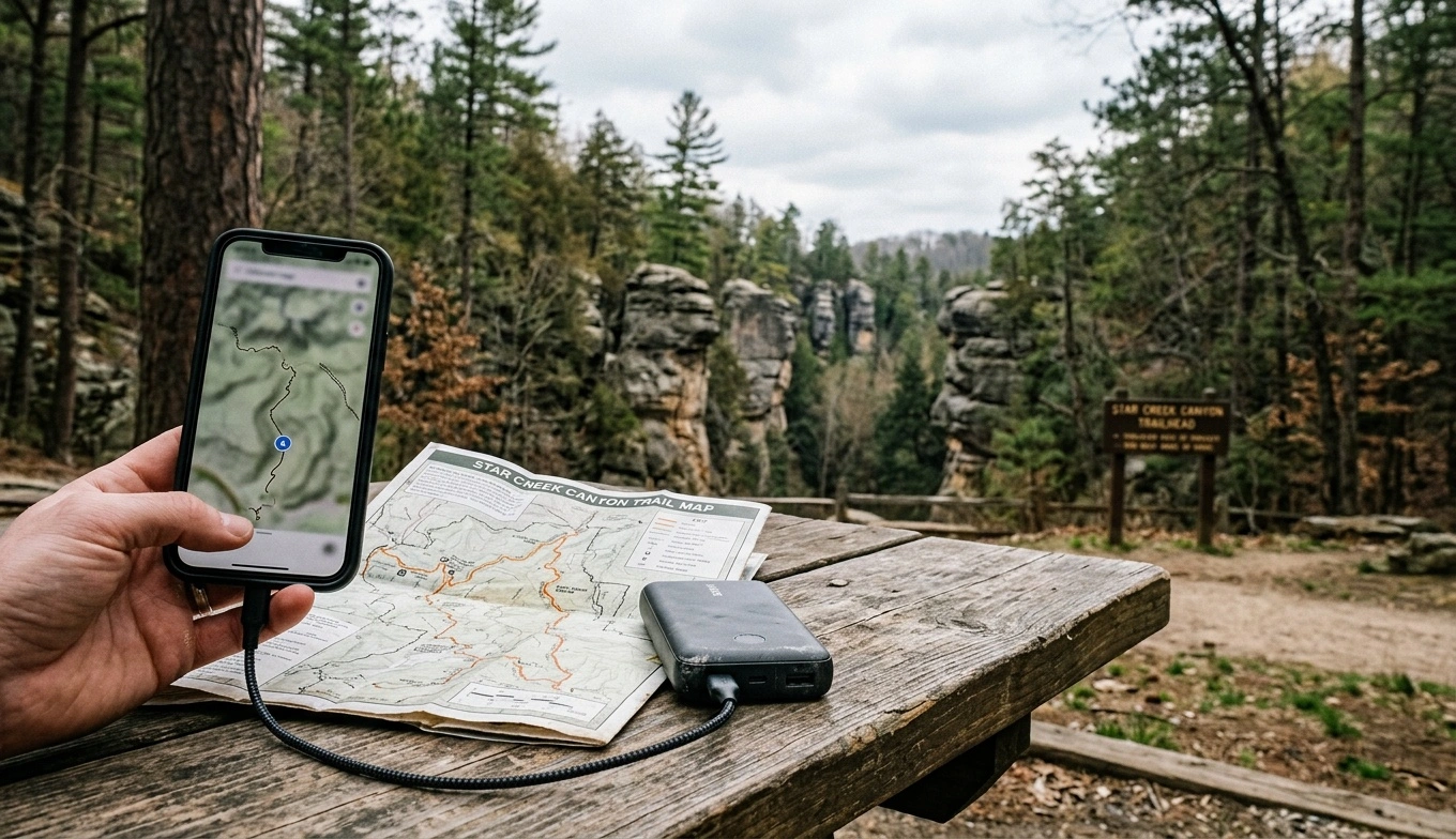
Hocking Hills cell service can disappear within one bend, especially after you enter a gorge or drive behind a sandstone ridge. Expect intermittent reception, and download essential information before leaving a town or major highway.
No public Wi-Fi network covers every park area. Your cabin, lodge, campground, or rental may offer Wi-Fi, but the connection may be slow or unreliable. Carrier maps provide a general overview. However, they cannot predict service inside Rock House, at the bottom of a gorge, or along every back road.
Treat your phone as an offline tool during your visit. Save maps, directions, reservations, door codes, and emergency contacts before the trip. Also, confirm current hours, closures, rules, and visitor services with the Ohio Department of Natural Resources and Ohio State Parks.
Why Hocking Hills Cell Service Is So Inconsistent
The cliffs and narrow valleys that draw visitors also interfere with mobile signals. Your phone may work near a ridge or open field, then lose service between rock walls. Thick summer foliage can weaken an already marginal signal.
Coverage also changes by carrier, phone, weather, and location. Two people in the same parking lot may get different results. A signal that supports a text may fail during a call or while loading a map.
Busy weekends create network congestion. Old Man’s Cave and the main visitor area can draw large crowds, even when nearby roads feel remote. A visible signal does not guarantee usable data.
Do not assume that a developed trailhead, restroom, or open parking lot has reliable reception. If information matters, save it offline. Include routes to your lodging, your next park area, and home.
What to Expect at the Main Park Areas
No trailhead offers reception that every visitor can rely on. The table describes general terrain patterns, not guaranteed coverage for any carrier. Service may change within a parking lot and often weakens below the rim.
Restroom and water access may change because of weather, maintenance, construction, or seasonal schedules. Check the current ODNR map and official alerts instead of relying on an old screenshot. Carry drinking water rather than planning to refill at each stop.
| Area | What to Expect From Cell Service | What to Prepare Before Arrival |
|---|---|---|
| Old Man’s Cave and the main visitor area | Service varies around the developed area. It may weaken or disappear after the trail enters the gorge. Crowds can also slow mobile data. | Save the official trail map, your next destination, and lodging directions. Check current visitor center and restroom information with ODNR. |
| Cedar Falls | Reception can be limited near the parking area. It often becomes less dependable near the falls and below surrounding ridges. | Download your onward route before arriving. Do not count on loading directions after the hike. |
| Ash Cave | The open approach may have a signal in some spots. The recess cave and surrounding terrain can block or weaken it. | Save directions to your next stop and confirm current facility information in advance. |
| Conkle’s Hollow | The narrow gorge often has weak or unavailable reception. Higher ground may offer service, but it is not guaranteed. | Carry an offline map and check current preserve rules, including pet rules. Never approach a rim edge to search for a signal. |
| Rock House | Service may vary around the parking lot. Do not expect reception inside the rock corridor. | Save your route and group meeting plan before leaving the parking area. |
| Cantwell Cliffs | This remote area can have spotty service along its roads and trails. | Download turn-by-turn directions. Make sure everyone in the vehicle knows the return route. |
| Lake Logan and nearby commercial areas | Open terrain and larger roads may improve the chance of service. Coverage still depends on your carrier and exact location. | Download maps, contact your host, and check official notices before driving farther into the hills. |
| Cabin and campground areas | Results vary sharply between properties. Nearby cabins may receive different signals when a ridge separates them. | Ask about carrier-specific reception, Wi-Fi, the preferred access road, and an offline check-in plan. |
Do not climb a slope, leave a designated trail, or approach a cliff edge to find service. Park rules prohibit off-trail hiking, and unprotected drops may sit above or beside the trail. Falls from cliffs and rim edges have caused serious injuries and deaths.
Wi-Fi at Cabins, Lodges, and Campgrounds
Internet performance varies widely among Hocking Hills properties. Some connections support streaming, while others can barely send a message. Remote properties may use fixed wireless or satellite internet because wired service cannot reach them.
Weather, trees, guest traffic, and router placement can affect performance. A listing that includes Wi-Fi may not support video meetings, gaming, or several televisions. Contact the property and ask what recent guests could realistically do online.
Ask whether the network reaches bedrooms, decks, or separate buildings. Large group cabins may have dead zones outside the main living area. Campground Wi-Fi may work best near a central building rather than at each campsite.
Save check-in instructions and door codes outside your email or booking app. A screenshot should include the address, access directions, host number, and gate instructions. For smart locks or app-based entry, ask how to enter without mobile data.
What to Download Before Leaving Home
Do not wait until you reach a trailhead to set up offline navigation. Download maps over dependable Wi-Fi, then test them in airplane mode. Saving a destination does not always download the surrounding map.
Each driver should have the necessary information. Do not keep every map and reservation on one phone. Weak signals also drain batteries faster, so carry a charged power bank and cable.
Printed directions and a paper park map remain useful in this area.
- Offline road maps: Include the park, your lodging, nearby towns, fuel stops, and your route home.
- Official trail maps: Use current ODNR or Ohio State Parks maps, not only a crowdsourced hiking app.
- Lodging details: Save the address, host number, check-in instructions, door code, and recommended approach road.
- Park information: Save current closures, alerts, rules, and visitor center details.
- Your itinerary: List trailheads, meeting times, and alternate stops in case a parking lot fills.
- Emergency contacts: Store important numbers on your phone and keep a written copy.
- Entertainment: Download music, podcasts, movies, or children’s programs before reaching your lodging.
Navigation on Hocking Hills Back Roads
Navigation problems often begin after visitors leave a state route for a county or township road. These roads can be narrow, hilly, dark, and sharply curved. Safe places to stop and reload directions may be scarce.
Some cabin driveways are steep, gravel-covered, or difficult to see after sunset. Ask your host for the preferred route instead of trusting the shortest app route. A slightly longer approach may offer safer or easier driving.
This choice matters during rain, snow, and darkness. Enter your destination while you still have service, but keep the full route available offline. Note the road names near your final turns.
If you miss a turn, continue to a safe pull-off. Do not stop in a curve or reverse along a narrow road.
Fill the gas tank before visiting remote trailheads. Carry water and snacks so lost service does not force you to search for a store. If a parking lot is full, park along the road only where signs and pavement markings allow it.
Keeping a Group Together Without Reliable Service
Choose a meeting point before anyone starts hiking. “Meet at the car” works better than “text us when you finish.” Agree on a time and decide when to follow the backup plan.
Text messages may go through when calls and mobile data fail. However, a message can remain pending for hours. A sent message does not prove that the recipient received it.
Parents should not expect continuous phone tracking inside a gorge. Groups with several vehicles should decide where each vehicle will go before leaving reliable service. For point-to-point hikes, record the other vehicle’s make, color, and parking location.
Some newer phones and dedicated devices include satellite messaging or emergency tools. Learn how your device works before the trip. Satellite features often need open sky and may struggle beneath cliffs or dense trees.
Emergencies When Your Phone Has No Signal
Do not make a mobile phone your only safety plan. Tell someone where you will hike, where you parked, and when you expect to return. Stay on designated trails so rescuers know where to begin searching.
In an emergency, try calling 911 even if your carrier shows no service. Your phone may connect through another available network, but this is not guaranteed. If the call fails, try a text where emergency text service operates.
Do not assume emergency services received a text unless you get confirmation. Move toward a safe, open location only if the move will not worsen an injury. Stay on the trail.
Never climb a rock face, cross a barrier, or approach an unprotected rim to search for service. Keep children close. Keep dogs leashed in areas where park rules permit pets.
Stone steps, sandstone, and wooden stairs become slick in rain and ice. Wear sturdy shoes throughout the year, and consider traction devices during freezing weather. Check ODNR alerts for closures caused by ice, high water, maintenance, or other hazards.
Do not climb, rappel, swim, or wade to bypass a trail hazard. Current rules restrict climbing and rappelling to designated areas.
Parking, Restrooms, and Information Without a Connection
Old Man’s Cave often fills early on popular weekends. Fall color, spring breaks, and mild-weather Saturdays can bring heavy traffic. Arriving early may help, but no arrival time guarantees a parking space.
Plan an alternate official park area in case your first choice is full. Save several options and the routes between them before your trip. Do not wait until you reach a crowded lot to research another trailhead.
Selected developed areas have restrooms, but the type, hours, and seasonal schedule can change. A restroom does not guarantee drinking water. Carry enough water for each hike and the drive between stops.
The official park map shows designated areas and trails more clearly than a general search result. Pick up a current paper copy when available. Confirm visitor center hours and services through ODNR before leaving home.
A paper map needs no battery, data plan, or software update.
Working Remotely From a Hocking Hills Cabin
Remote work from a cabin requires more planning than a typical weekend trip. Ask the host about connection speed, recent outages, and mobile reception for your carrier. Also, find out whether the router works during a power outage.
If you cannot miss a meeting, identify a backup location outside the cabin. Do not assume a phone hotspot will fix weak Wi-Fi. The ridge blocking one service may block the other.
A hotspot may work well at one property and fail a short drive away. Download documents, presentations, and shared files before arrival. Make essential files available offline.
Check whether your work software requires a new login or authentication code. Two-factor authentication can fail if the code arrives by text. An authenticator app or approved backup method may work better, depending on your employer’s security rules.
Tell colleagues that your connection may be inconsistent. Do not promise uninterrupted availability. If the trip is a vacation, setting clear expectations also makes it easier to disconnect.
Seasonal Signal and Travel Considerations
Signal conditions can change with the seasons. Full summer foliage may weaken marginal reception. Winter removes the leaves but can bring ice, snow, closures, and power interruptions.
Spring rain can strengthen waterfalls and create muddy trails. It may also make back roads and cabin driveways harder to navigate. Fall weekends bring more traffic, which can affect parking and mobile data at the same time.
During peak fall color, download everything before leaving home. Do not depend on a crowded trailhead for last-minute downloads. Cold weather also shortens battery life, so keep your phone and power bank inside a coat or pack.
A common mistake is assuming a map will stay available because it loaded once. Visitors also leave cabin addresses inside email messages that may not reopen offline. Meanwhile, a phone can drain its battery quickly while searching for a signal.
- Take screenshots of addresses, door codes, and essential messages.
- Download maps for the park, surrounding towns, and your route home.
- Bring a power bank and vehicle charger.
- Ask your lodging host which approach road to use.
- Set group meeting times before entering a gorge.
- Never leave a designated trail or approach a cliff to search for service.
- Check current hours, closures, pet rules, weather restrictions, and facility details with ODNR and Ohio State Parks.
Plan Around Hocking Hills Cell Service
Assume your phone will work sometimes, but not exactly when you need it. Treat any connection as a convenience rather than the foundation of your day. Offline maps, written directions, charged batteries, and a clear group plan prevent many common problems.
Ask specific questions about lodging Wi-Fi if work, streaming, or video calls matter. Save all check-in information and verify your route before entering the hills. On the trail, follow the designated route and never take risks to reconnect.
Before leaving, check ODNR and Ohio State Parks for current closures, hours, trail conditions, rules, and visitor services. A few minutes of preparation can prevent missed turns, locked cabins, and separated groups.










Share This Page